
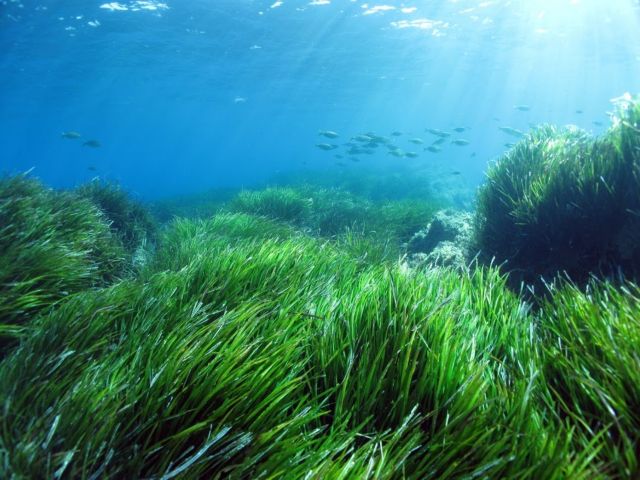
Posidonia oceanica is a seagrass species that, when they are alive, form dense green clusters in sandy seabeds and when they are dead they get a grayish-black lying in the coastline like a dense carpet. In reality, however, these higher plants are called Posidonia oceanica and they come from the land. The genus Posidonia, belongs to the category of marine phanerogams, is native to the Mediterranean sea, that is, is located only in this sea. It is estimated that the Posidonia meadows formed in the Mediterranean coastal zones in depths of 3 to 50 meters, covering an area of between 25,000 and 50,000 km2 (2% of its undersea bottom). Its leaves can reach 1m and are green. When they age, they fall, and drifting from the wave, blacking out in the sand, and actually these are the brown ribbons we meet often on the beaches. (There are also encounters in the Mediterranean and in the Greek seas, and other 4 species of marine phanerogams (Zostera marina, Zostera noltii, Cymodocea nodosa and Halophila stipulacea).
They absorb nutrients from roots (such as terrestrial plants) and leaves. They form meadows with a) the elongation of the roots and shoots in horizontal and vertical arrangement from which new leaf bundles are born; b) drifting (from waves, sea currents), their leaves are installed and create new tufts. They are characterized by high biodiversity (number of species), offering habitat (shelter), food, protection, a place for safe breeding in a number of marine organisms (sea urchins, fish, sea anemones, starfish, worms).
Moreover, they produce huge amounts of dissolved oxygen. In addition, they protect the coast from erosion by altering the action of coastal waves and currents. It grows exclusively in clean waters, so where they exist, the beach and the sea are clean for swimming.
A serious cause of degradation of the Posidonia grasslands is the activity of the towed fishing gear (trawls) and the anchorages of ships that eradicate the plants from the bottom. A tuft eradicated by an anchor creates a gap that it takes decades to be replenished.
Using the MBES SeaBat T20-R, appropriately, SeaMap is able to apply a detailed mapping of this sensitive ecosystem.