
-
Seabed Sounding – Mapping
MoreThe seabed sounding is applied using the Ultra High Resolution multibeam Multi-detect Teledyne Reason T20 R that overcovers the International Hydrographic Organization – I.H.O. instructions
-
-
About
The company, through a multi-year experience, undertakes all kinds of marine topographic surveys, hydrographic depictions, mappings etc.
Our services
We provide complete submarine services based on greek and european legislation.
The seabed sounding is applied using the Ultra High Resolution multibeam Multi-detect Teledyne Reason T20 R that overcovers the International Hydrographic Organization – I.H.O. instructions […]
Dredged Material Volume Measurements
The data collected using the MBES system allow the high-resolution DTM extraction (using CUBE filters etc.) of the seabed. By the seabed mapping before and […]
There is the possibility to create 3D area representation in the InfraWorks 360 environment that allows spatial information to be compiled from different sources such […]
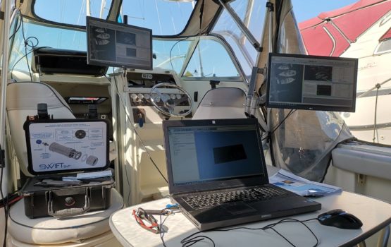
Uptodate equipment
We own equipment of new technology for accomplishing every task, like surveying boat, echosounder and underwater cameras.
Our work
We carry out hydrographic and marine projects/studies based on our multi-year experience, using uptodate technology.
Our clients